


Pars III: Colonia, Treveri, Argentoratae (Segments II, III), Peutinger Table
Pars III: Colonia, Treveri, Argentoratae (Segments II, III), Peutinger Table
Couldn't load pickup availability
SKU:B6QLVPT3YRX9E
PAY IN THREE INSTALLMENTS WITH PAYPAL
DO YOU WANT TO KNOW WHAT THE PEUTINGER TABLE IS?
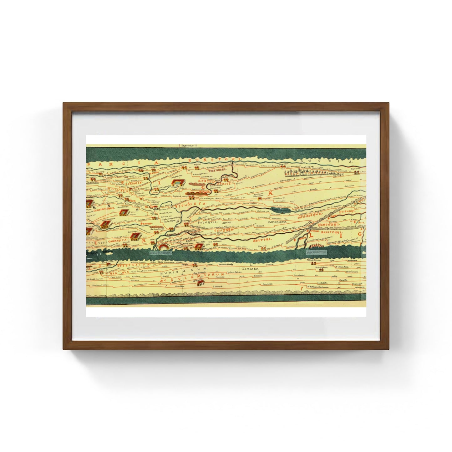
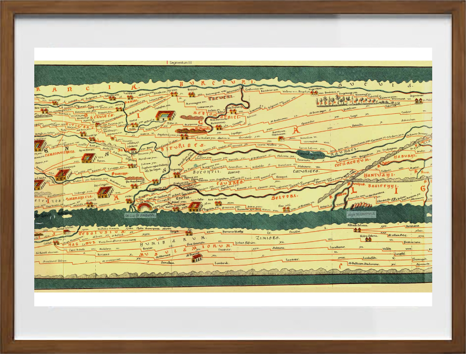
Pars III of the Peutinger Table features the cities of Cologne (Colonia Claudia Ara Agrippinensium, now Cologne), Treveri (Augusta Treverorum, now Trier), and Argentoratae (now Strasbourg). Pars III represents one of the central portions of the famous Roman road map.
This section encompasses a vast area of Roman Gaul and neighboring regions. It includes Gallia Belgica: the area encompassing key cities such as Cologne and Trier, among the main administrative and military centers of the Roman Empire at the time; and Germania Inferior and Germania Superior, with important cities and junctions on the banks of the Rhine, illustrating the road connections between Gaul and Roman Germania. The Rhine is clearly visible as an administrative and strategic demarcation line.
The main cities depicted are: Cologne (Colonia Claudia Ara Agrippinensium), which is marked with a complex building icon, highlighting its importance both as the capital of the province of Germania Inferior and as a commercial hub; Treveri (Augusta Treverorum), represented by a large city symbol, which was the capital of Gallia Belgica and the imperial residence for various periods; and finally Argentoratae, an important center on the western bank of the Rhine, represented by a special symbol.
Numerous castles, post stations, and minor settlements are also shown, useful for rebuilding the dense network of Roman infrastructure. Therefore, Pars III offers a valuable overview of Roman road communications in northern Gaul and the Rhine provinces, highlighting the importance of the Roman road system for the movement of troops, goods, and officials. It also demonstrates the centrality of Colonia, Treveri, and Argentoratae in the heart of the Gallo-Germanic lands, effectively depicting the organization, scope, and impact of Roman road systems in maintaining the unity of a vast and multifaceted empire.
DO YOU WANT INFORMATION ON THE PRODUCT? WHATSAPP CHAT WITH A CONSULTANT
FEATURES
A framed print creates a visual impact worthy of an art gallery. The beveled mounting board around the image is made of genuine museum-quality cardboard: a decorative element for experts.
The special charm of a framed print also lies in its elegant, handmade frame. Each print is protected by crystal-clear acrylic glass.
Product Specifications:
Print: (260 g/m²) with a brilliant white gloss finish
Mounting board: White, 45° bevel cut
Size: 60 x 40 cm
Material: Acrylic glass and wooden frame

Scopri i pregiati materiali di Trizio Editore
Carta di Amalfi fatta a mano, cornice in legno di faggio e vetro museale. Guarda i particolari dei prodotti che renderanno la tua casa più elegante e preziosa.