Map of Rome 1572 - Joris Hoefnagel
Map of Rome 1572 - Joris Hoefnagel
o una misura particolare? • Avvia chat WhatsApp
Couldn't load pickup availability
SKU:N7P3L9V4M6T5K8
Historical map of the city of Rome from the late sixteenth century, created by Joris Hoefnagel. It is a colored engraving.
The map highlights sixteenth-century Rome, urbanized and organized into districts, and crossed by the great Tiber River. The map also shows the city's outer walls with regularly spaced bastions. The seven hills are also depicted, and in the background are the Alban Hills. At the bottom of the map are two legends, highlighted in blue on the left side and in red on the right side.
Georg Hoefnagel Hufnagel (Antwerp, 1542 – Vienna, 1600) was a Flemish painter, cartographer, and illustrator.
Feel history at your fingertips
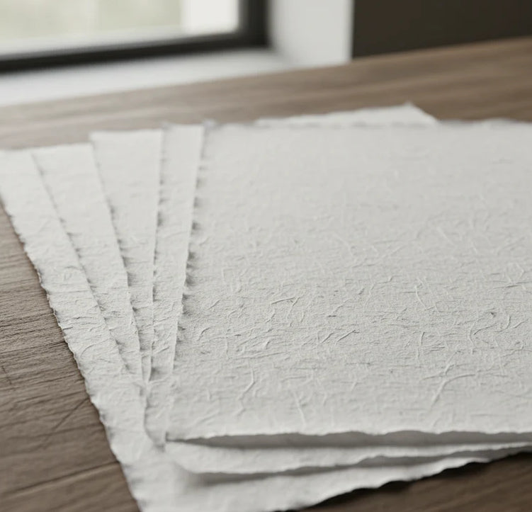
Our reproductions are faithful to the original and printed on precious Amalfi paper.
It is a paper made exclusively from cotton fibers, thick and naturally porous, yet soft to the touch, with characteristic frayed edges that attest to its artisanal craftsmanship.
It is still made today according to ancient medieval techniques in the workshops of Amalfi.
Sublime quality materials
-
 Amalfi Paper
Thick, porous, with characteristic frayed edges -
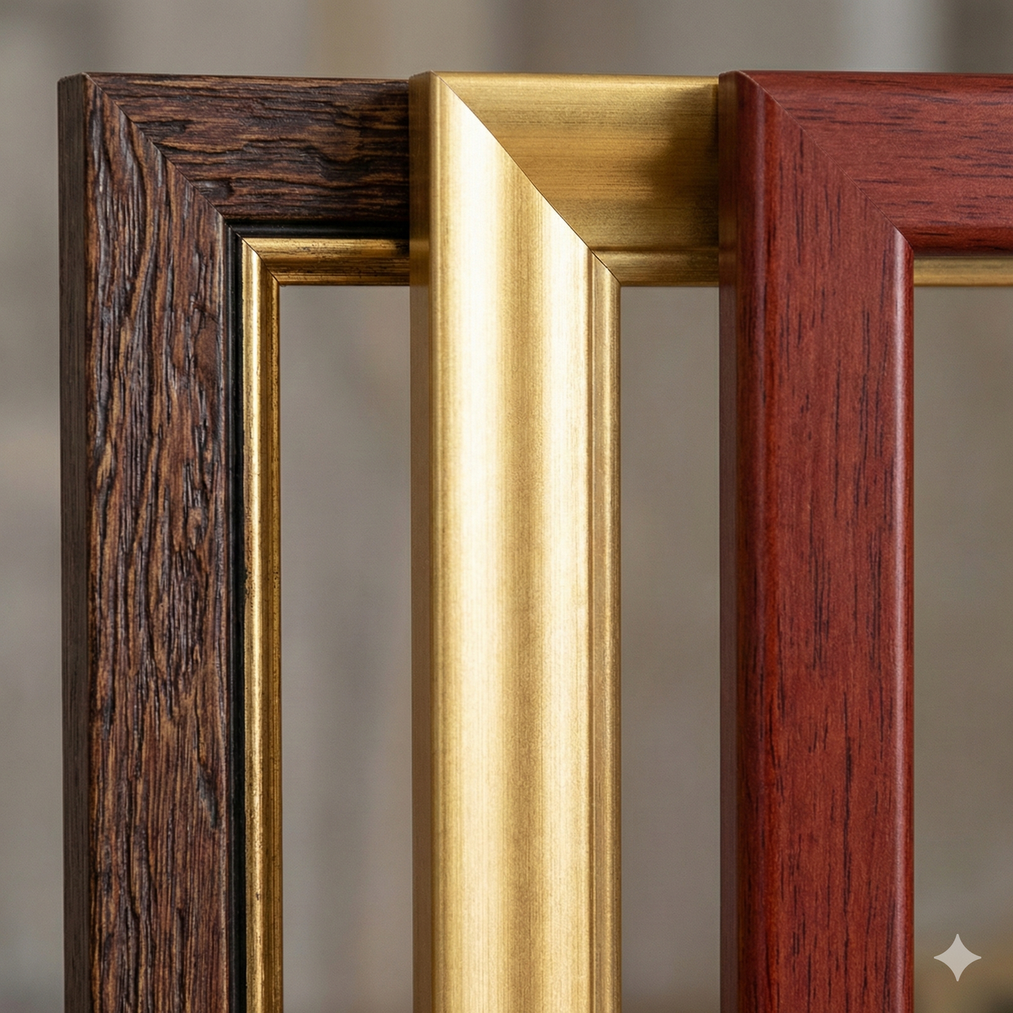
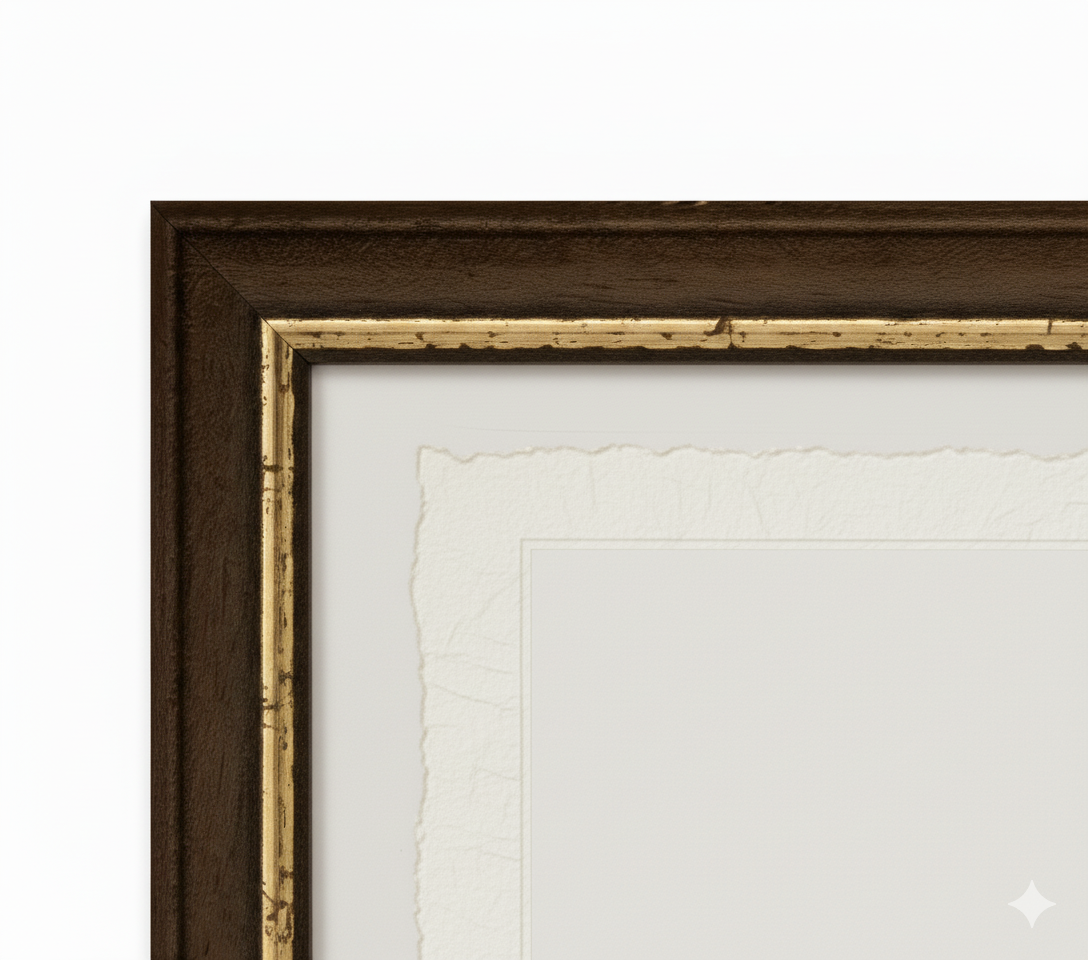
 Handcrafted frame
Made of fine wood, hand-assembled -
 Museum glass
The same ultra-clear glass used in museums
Unique quality material
Printed on handmade Amalfi paper
Sheet size: 40 x 30 cm
With frame: 43 x 33 cm
Material: artwork printed on precious handmade Amalfi paper with frayed edges
Frame: Light brown, handmade beech wood and wood pulp