Map of Europe - Willem Blaeu
Map of Europe - Willem Blaeu
o una misura particolare? • Avvia chat WhatsApp
Couldn't load pickup availability
SKU:T9M8P5V1L2T4K7
Historical map of Europe from the late sixteenth century created by Willem Janszoon Blaeu. It is a colored engraving.
The map is rectangular and shows all the states of Europe as they were at the end of the sixteenth century. It includes the largest cities and rivers. Around the map there are images, these are allegories (on the sides) while at the top there are drawings of places.
Willem Janszoon Blaeu, Latinized Guilielmus Jansonius Blavius (1571 – Amsterdam, 1638), was a Dutch cartographer and publisher.
The son of a merchant, he was an author, printer, and publisher of maps and globes, which he signed until 1621 with the name Guljelmus Caesius.
Feel history at your fingertips
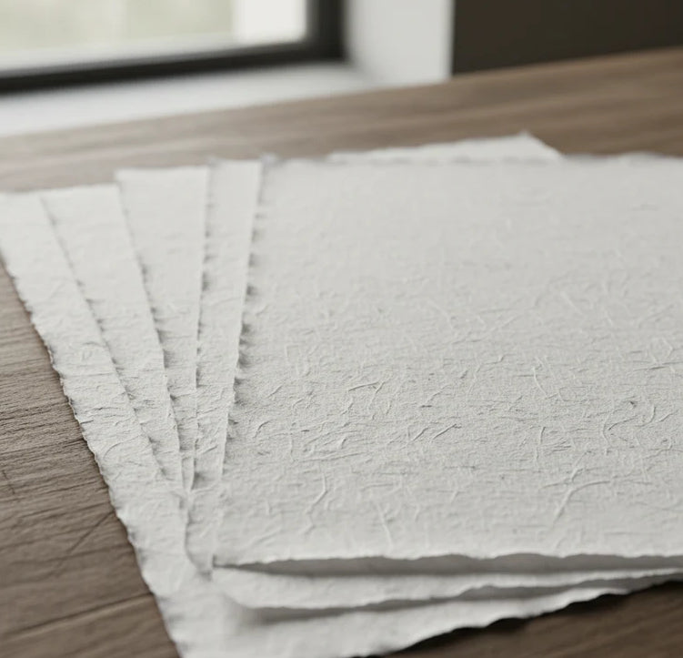
Our reproductions are faithful to the original and printed on precious Amalfi paper.
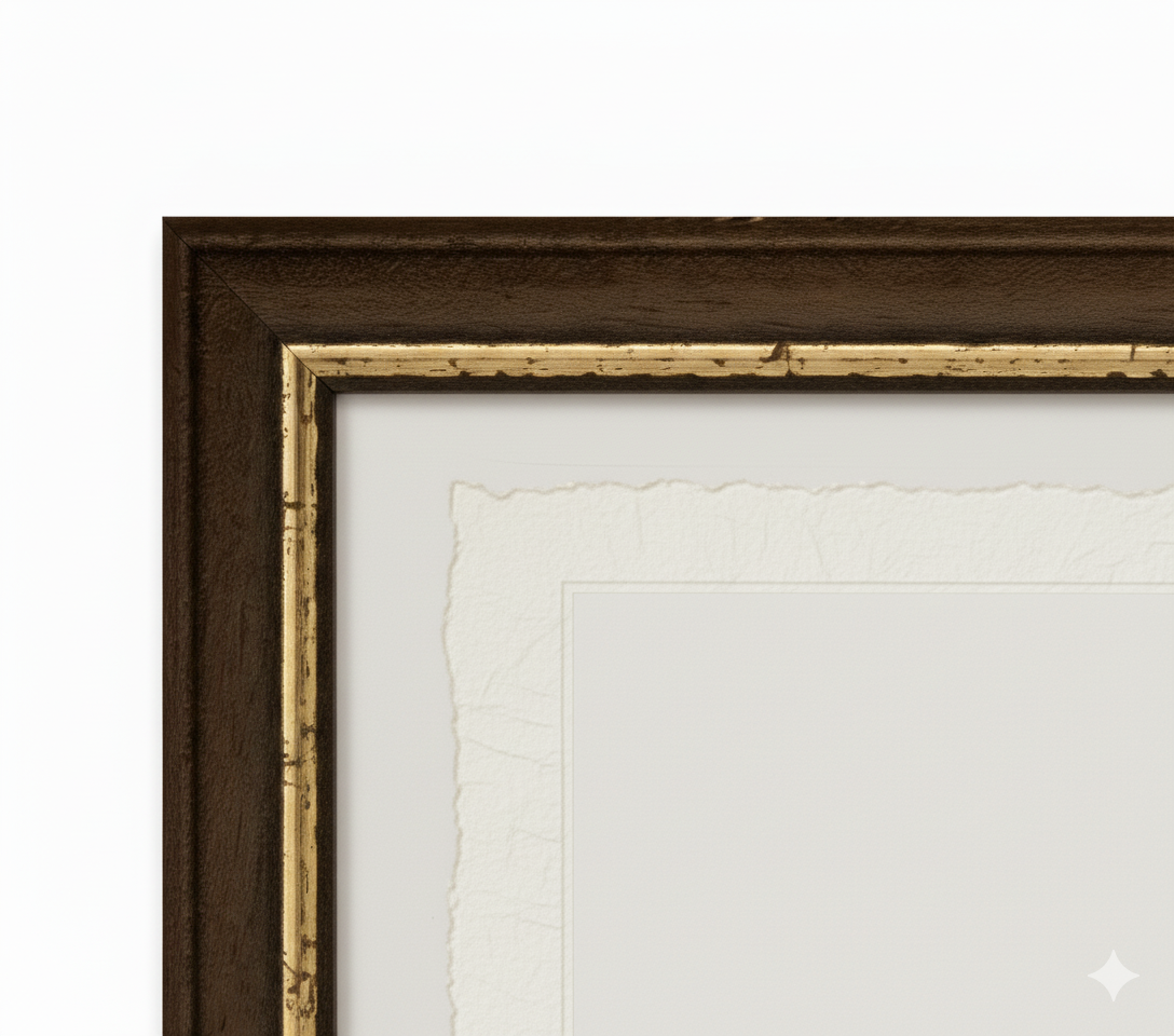
It is a paper made exclusively from cotton fibers, thick and naturally porous, yet soft to the touch, with characteristic frayed edges that attest to its artisanal craftsmanship.
It is still made today according to ancient medieval techniques in the workshops of Amalfi.
Materials of sublime quality
-
 Amalfi Paper
Thick, porous, with typical frayed edges -
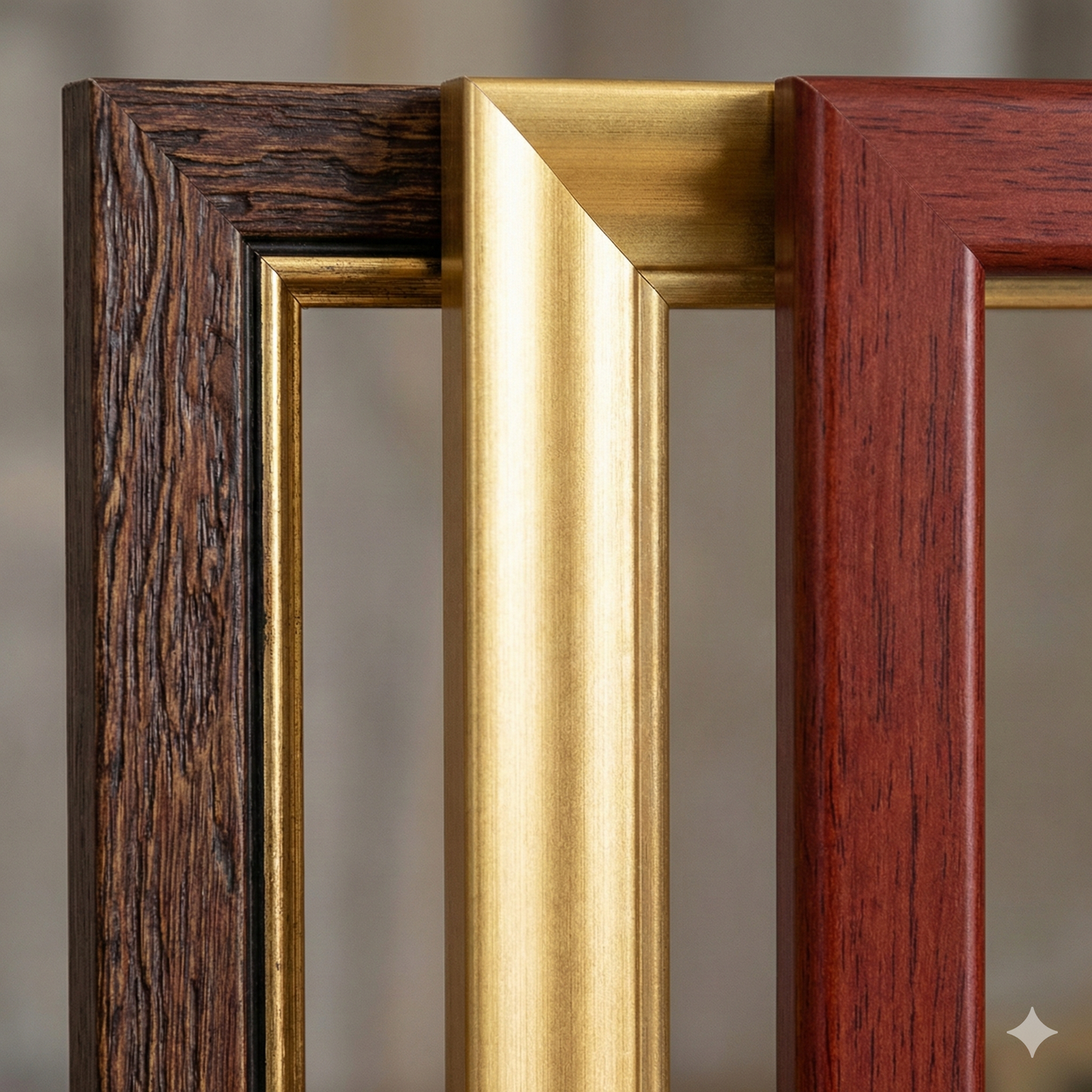
 Handcrafted Frame
Made of precious wood, hand-assembled -
 Museum Glass
The same ultra-clear glass used in museums
Unique quality material
Printed on handmade Amalfi paper
Sheet size: 40 x 30 cm
With frame: 43 x 33 cm
Material: work printed on very high-quality handmade Amalfi paper with frayed edges
Frame: Light brown, made of beech wood and handmade wood pulp