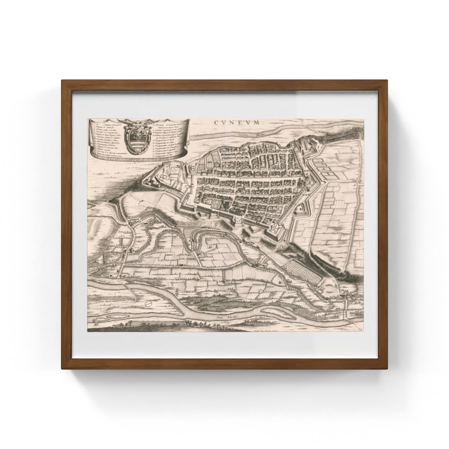
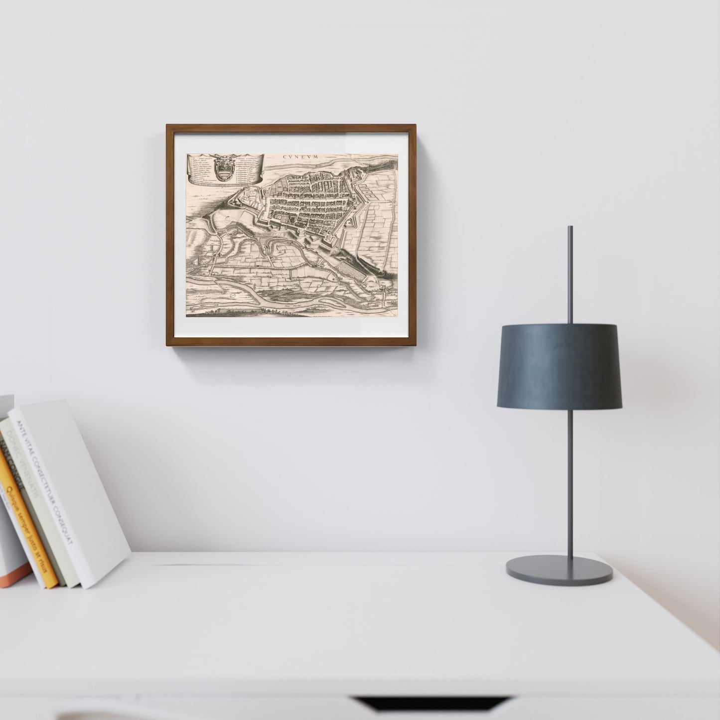
Map of the ancient city of Cuneo by Johannes and Cornelis Blaeu
Map of the ancient city of Cuneo by Johannes and Cornelis Blaeu
Couldn't load pickup availability
SKU:T2M4N7L9K1P6Q
PAY IN THREE INSTALLMENTS WITH PAYPAL
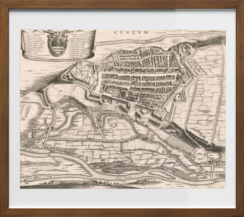
The map of the ancient city of Cuneo by Johannes and Cornelis Blaeu, dating from the mid-17th century, represents a prestigious cartographic testimony of this Piedmontese city. Finely engraved on copper, the map offers a detailed view of Cuneo’s urban structure, highlighting the fortified walls, access gates, and the internal organization of the city during a historically significant strategic period. The attention to detail, typical of the Blaeu school, makes this map a cartographic artwork rich in historical and cultural value.
The depiction also emphasizes Cuneo’s position within its surrounding territory, suggesting its importance as a fortified city in the political and military dynamics of 17th-century Piedmont. The careful engraving allows admiration of the main buildings and the design of the fortifications in the geometric style characteristic of that era, providing a visual testimony that connects the city to the tradition of Savoyard and European cartography. An ideal map for collectors, historians, and historical cartography enthusiasts eager to discover the past of a city full of history and charm.
DO YOU WANT INFORMATION ON THE PRODUCT? WHATSAPP CHAT WITH A CONSULTANT
FEATURES
A framed print creates a visual impact worthy of an art gallery. The beveled mounting board around the image is made of genuine museum-quality cardboard: a framed photo is a decorative element for experts.
The special charm of a framed print also lies in its elegant, handmade frame. Each print is protected by crystal-clear acrylic glass.
Product Specifications:
Print: (260 g/m²) with a brilliant white gloss finish
Mounting board: White, 45° bevel cut
Size: 40 x 40 cm
Material: Acrylic glass and wooden frame
Scopri i pregiati materiali di Trizio Editore
Carta di Amalfi fatta a mano, cornice in legno di faggio e vetro museale. Guarda i particolari dei prodotti che renderanno la tua casa più elegante e preziosa.


