Detail of the geographical atlas of the Kingdom of Naples by Giovanni Antonio Rizzi-Zannoni
Detail of the geographical atlas of the Kingdom of Naples by Giovanni Antonio Rizzi-Zannoni
o una misura particolare? • Avvia chat WhatsApp
Couldn't load pickup availability
SKU:YQ1X6V3S8R7U9
This splendid plate is part of the famous geographical atlas of the Kingdom of Naples, which was outlined by order of Ferdinand IV, King of the Two Sicilies, by Giovanni Antonio Rizzi-Zannoni, His Majesty's geographer, and completed in 1808. This edition was presumably published in 1820, based on the dedication to Ferdinand IV on the title page: an update to the original 1808 edition, which still cited Napoleon. Ferdinand reigned until 1825.
Giovanni Antonio Rizzi-Zannoni (1736–1814) worked in Naples for over twenty years, first as royal geographer and then, from 1781, as director of the Topographical Office. The maps in the atlas, based on trigonometric surveys, represent a significant advancement in Italian cartography for their precision and method, as the Cassini projection was adopted.
This particular plate consists of two main sections: the cartographic section on the left, which presents a detailed map of the coastal region. One can observe: mountainous reliefs, an indented coastline, indicative of the territory's geomorphology, and the sea, which is represented with some sailing boats, suggesting the maritime activity of the era. Indications for "Western Distances" and "Southern Distances" and the subdivisions of "Eastern Division" and "Naples Meridian" are also visible.
The title section on the right, more artistic, contains the complete title of the atlas and an allegorical illustration. The title, framed by a cloud of volcanic smoke, confirms the author, the commissioner, and the publication year of the plate. Below the title, the landscape depicts an erupting volcano, probably Vesuvius, some allegorical female figures surrounded by natural elements such as rocks and vegetation, and the coastal landscape.
The atlas, in addition to being a crucial geographical tool, is a tangible testament to an era of great political and scientific changes, a true artistic and technical masterpiece that continues to enchant with its beauty and historical accuracy.
Feel history at your fingertips
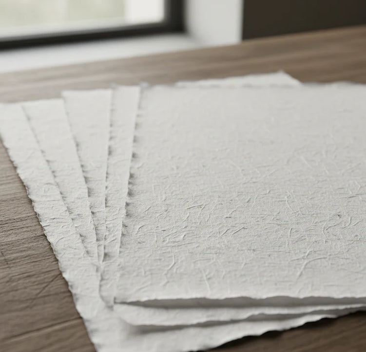
Our reproductions are faithful to the original and printed on precious Amalfi paper.
It is a paper made exclusively from cotton fibers, thick and naturally porous, yet soft to the touch, with characteristic frayed edges that attest to its artisanal craftsmanship.
It is still made today using ancient medieval techniques in the workshops of Amalfi.
Materials of sublime quality
-
 Amalfi handcrafted paper
Thick, porous, with typical frayed edges -
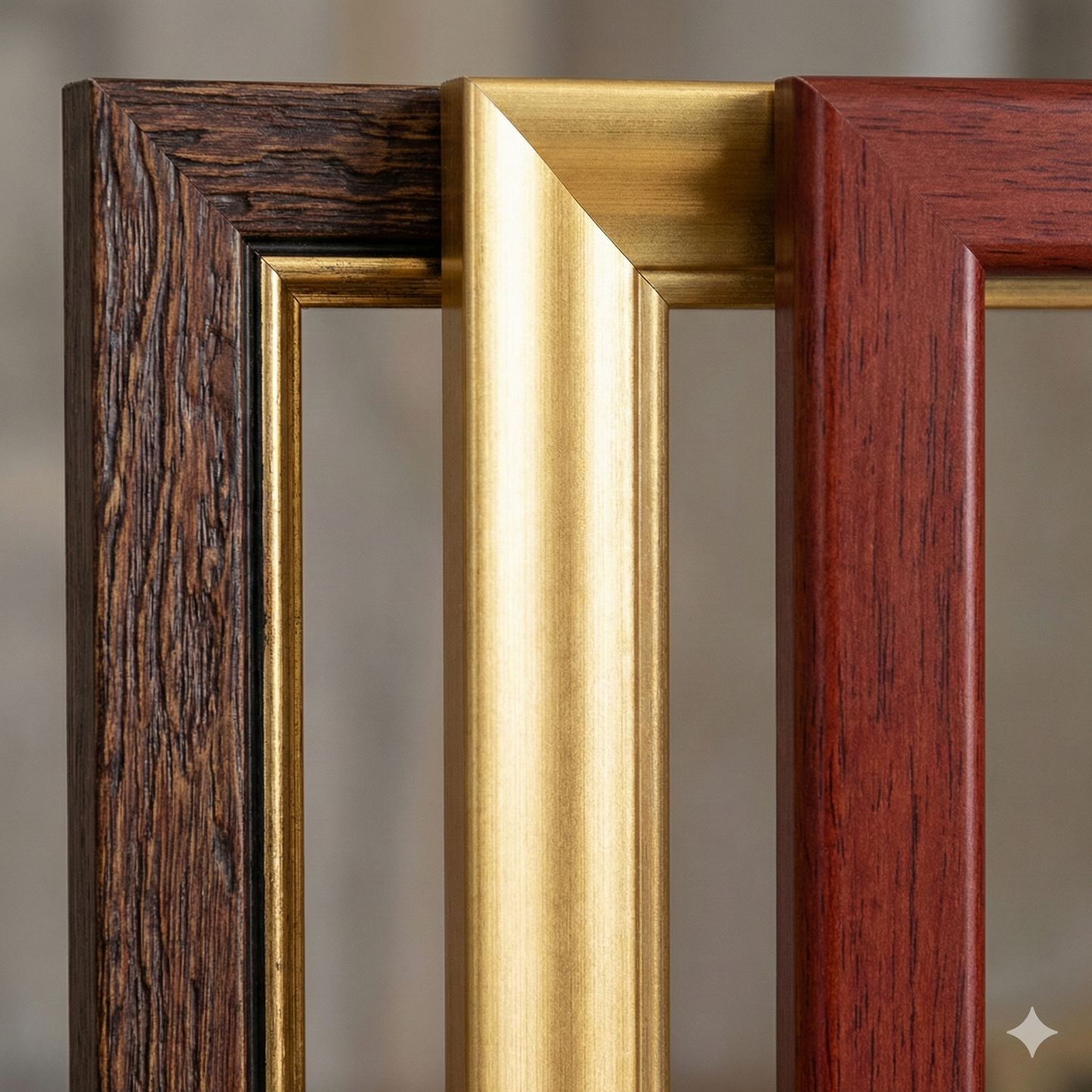
 Handcrafted frame
Made of precious wood, hand-assembled -
 Museum glass
The same ultra-clear glass used in museums
Material of unique quality
Print on handmade Amalfi paper
Sheet size: 40 x 30 cm
With frame: 43 x 33 cm
Material: artwork printed on very high quality handmade Amalfi paper with frayed edges
Frame: Light brown, made of beech wood and handmade wood paste