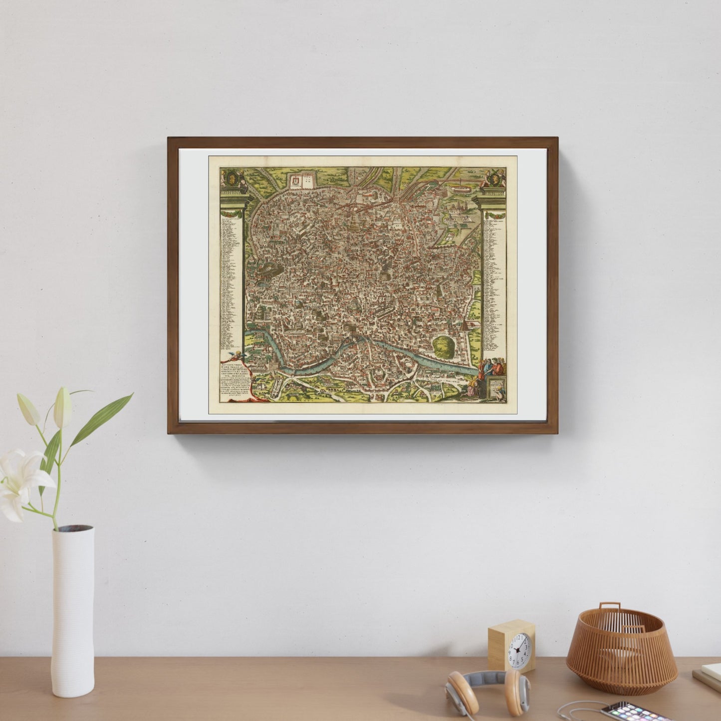
Antiquae Urbis Romae Imago Accuratiss Ex Vetustis Monumentis (1696)
Antiquae Urbis Romae Imago Accuratiss Ex Vetustis Monumentis (1696)
Couldn't load pickup availability
SKU:X1Y2Z3A4B5C6D
The work
Antique and finely colored map of ancient Rome, published by Pieter van der Aa and inspired by the Renaissance cartographer Pirro Ligorio, illustrating Rome in the time of Augustus. At the center of the map is the Tiber river, represented with great detail, crossed by seven bridges labeled with ancient Roman writings, among which the Pons Aemilius stands out, the oldest stone bridge in Rome, portrayed in its original form. The map shows a wide range of fortifications, intricate architecture and landmarks, such as the Colosseum, Circus Maximus and the Pantheon, all depicted in great detail. The Roman Forum, the political, legal and religious heart of the city, is accurately described with its surrounding temples, basilicas and public spaces. The map also includes the Servian Wall, the fortification built around Rome in the 4th century BC. There is a legend that describes and references 269 points of interest, each corresponding to a numerical notation on the map, allowing for detailed exploration of the city.
DO YOU WANT INFORMATION ON THE PRODUCT? WHATSAPP CHAT WITH A CONSULTANT
WHY BUY
- Magnificent and real colors
- It makes any room elegant
- Perfect for a prestigious gift
CHARACTERISTICS
A framed photographic ULTRAHD print gives a visual impact worthy of an art gallery. The beveled passe-partout around the image is made of real museum cardboard: a framed photo is a decorative element for connoisseurs.
Your photo is immediately ready to hang. Printed with razor-sharp resolution and brilliant colours.
The special charm of a framed photo print is also in its elegant handmade frame. Each print is protected with crystal clear acrylic glass.
Product Specifications :
Printed photo (260 g/m²) with a bright white gloss finish
White passe-partout cut with a 45° bevel
Measurement : 80 x 60 cm
Material : Acrylic glass and wooden frame
How reproductions are made


Scopri i pregiati materiali di Trizio Editore
Carta di Amalfi fatta a mano, cornice in legno di faggio e vetro museale. Guarda i particolari dei prodotti che renderanno la tua casa più elegante e preziosa.


