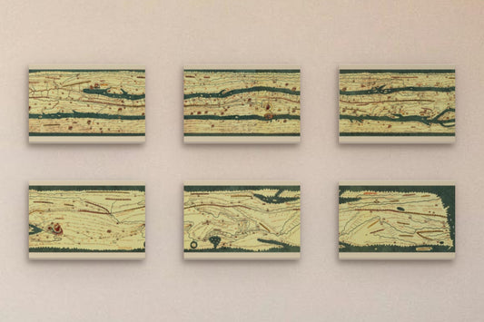
Collection: Peutinger Table
The Peutinger Map is a 12th–13th-century copy of an ancient Roman road map showing the roads of the Roman Empire, from the British Isles to the Mediterranean region and from the Middle East to India and Central Asia; its westernmost section is now lost. It is named after the humanist and antiquarian Konrad Peutinger, who inherited it from his friend Konrad Celtis, librarian to Emperor Maximilian I. In 2007, it was added by UNESCO to the Memory of the World Register. It is currently held in the Austrian National Library in Vienna.
The map is probably a copy of a Carolingian-era model, which itself was based on an original Roman road map. It is drawn schematically, and geographical features, with a few exceptions, are highly distorted. However, it provided travellers with all the relevant information about the locations of the most important cities and stops along the Roman Empire's road network, as well as the daily stages on the main travel routes.
The territories are represented by horizontal bands separated by seas. Cities are indicated by building icons, with the larger the symbol, the more important the city. The daily stages are shown by dividing red lines into segments. It also includes ancient place names and distances in Roman miles.