
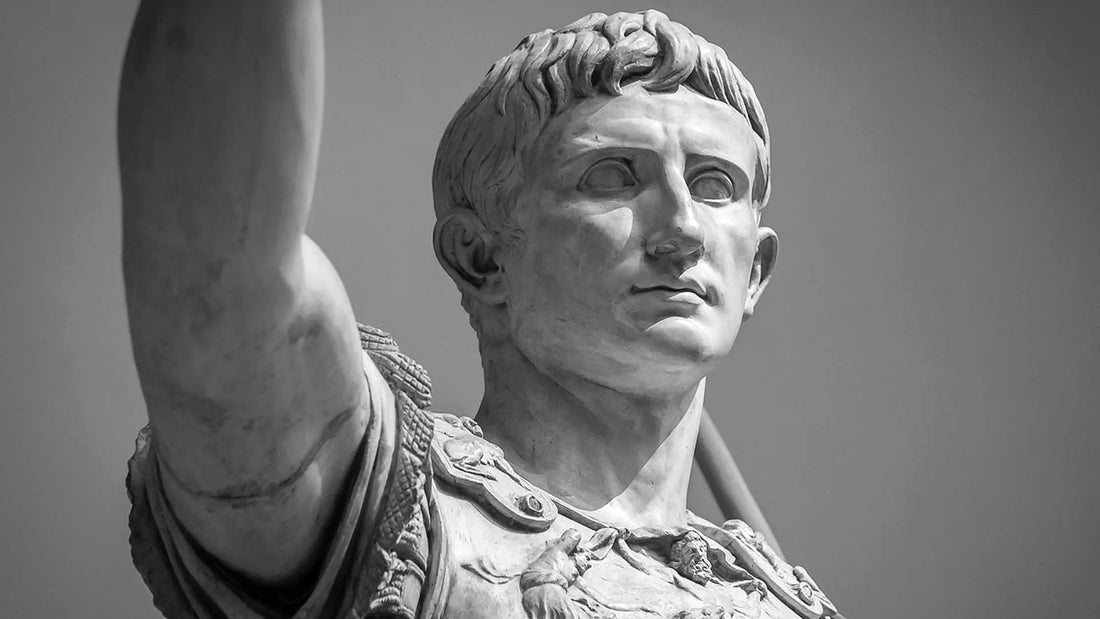
The Roman Empire under Augustus: history and borders
Alice Pettirosso

Fine art print on Amalfi paper
The map of the Roman Empire under Augustus, with the later provinces
- From the first edition (1859) of Heinrich Kiepert's atlas
- Printed on handmade Amalfi paper, with deckled edges
- Hand-assembled beech wood frame and museum glass
- Sheet 42 x 29 cm (16.5 x 11.4 in), 44 x 31 cm (17.3 x 12.2 in) framed
from €145
Available with a handmade frame or without a frame
Pay in 3 interest-free instalments with PayPal
Tracked
and insured shipping


In 27 BC Rome ceased to be a republic at war with itself and became an empire. Leading it was Octavian, whom from that moment the Senate called Augustus. In forty years of rule he drew the borders that Rome would keep for centuries: the Rhine and the Danube to the north, the desert to the south, Egypt as the capital's granary.
On this page we retrace how that empire was born and how far its borders reached. At the heart of the story is a map: the map of Augustus's empire drawn in 1859 by Heinrich Kiepert, one of the greatest cartographers of the nineteenth century, which we chose to print by hand on Amalfi paper.
The rise of Octavian Augustus
Octavian was born on 23 September 63 BC. When Julius Caesar, his great-uncle and adoptive father, was assassinated in 44 BC, he discovered that he was his heir. He was nineteen, and before him stood two powerful rivals: Mark Antony and Lepidus.
In 43 BC the three allied in the Second Triumvirate, but the agreement did not last long. Lepidus was sidelined and in 31 BC, at the battle of Actium, Octavian defeated Antony and Cleopatra. The following year, in 30 BC, Egypt became Roman. In 27 BC Octavian formally returned his powers to the Senate, which conferred on him the title of Augustus: it was the beginning of the principate.
The administrative structure of Augustus and the division of the provinces
To govern such a vast territory Augustus divided the provinces into two groups. The senatorial provinces, long pacified, were entrusted to proconsuls chosen by the Senate. The imperial provinces, on the frontier and full of legions, remained under his direct control and were governed by his legates.
Alongside the senators, Augustus gave weight to the knights, the equites: they managed the finances of the provinces and received sensitive posts, such as the government of Egypt, entrusted to a prefect of equestrian rank. It is this division that Kiepert's map makes visible, province by province.
The extent of the Empire's borders
This is the map of the empire Augustus left at his death, in AD 14. It is not yet the greatest extent, which would come a century later under Trajan, but it is the design on which Rome would build everything else.
Augustus completed the conquest of Hispania, organised Gaul and pushed the borders as far as the Danube, with the new Alpine and Balkan provinces. In Germania his generals' campaigns pushed the legions beyond the Rhine, until, in AD 9, three legions were destroyed in the Teutoburg Forest. From then on the Rhine became the border of the empire.
To the south and east Rome controlled Egypt, Judaea and the rich regions of the eastern Mediterranean. Along the frontiers the legions were stationed, and from then on they remained there permanently: this is the limes, the line that protected the empire and made possible the Pax Romana, about two centuries of relative peace and prosperity.
Kiepert draws all this with the precision of the great nineteenth-century atlases: the cities, roads, rivers and mountains of the empire in the time of Augustus, together with the provinces that would be added after him. It is a map to look at from afar, for the shape of an empire embracing the Mediterranean, and up close, to read the names that held three continents together.

Bring Augustus's empire to your wall
Kiepert's map of 1859, printed on handmade Amalfi paper. You can have it without a frame or in a hand-assembled beech frame with museum glass: 44 x 31 cm, ready to hang.
from €145 · tracked and insured shipping
Pay in 3 interest-free instalments with PayPal
Buy the mapWhy it is not a poster
A map like this can be printed on any paper. We chose the oldest paper in Italy.

Amalfi paper. Made of pure cotton fibres, thick and soft to the touch, with the deckled edges that come from making it by hand.

Handcrafted frame. In beech wood, assembled by hand by our craftsmen, with the ultra-clear glass used in museums.

Embossed mark. Every map bears the Trizio Editore mark, blind-embossed into the Amalfi paper.
The principate: a new system of power
The principate is a monarchy that preserves the forms of the Republic. Augustus had himself called princeps, first citizen, and left the Senate and the magistracies in place, but kept the army, the finances and policy for himself. After decades of civil war, Rome found stability again.
The Romanisation of the Mediterranean basin
With peace, the language, laws and way of life of the Romans spread. The cities of the provinces filled with roads, aqueducts and theatres, and Roman citizenship began to reach the provincial elites too, binding them to Rome. The roads Kiepert traces on the map are the very ones that carried Rome to every corner of the Mediterranean.
A master of propaganda
Augustus knew that power is also preserved through images. The Ara Pacis, the altar dedicated to the Augustan peace, celebrates the prosperity of the new regime with its reliefs; coins, statues and inscriptions spread throughout the empire the face of a pious and victorious ruler.
The Scripta Manent documentary
«Ottaviano Augusto. La vita del primo imperatore di Roma» (in Italian)
An hour-long account by Roberto Trizio · watch it on YouTube
The circle of Maecenas
Poetry, too, worked for Augustus. His friend and collaborator Maecenas was the patron of some of the greatest poets of the age, such as Virgil and Horace, who in their works sang the greatness of Rome and of its prince. The Aeneid became the national poem of the empire.
The organisation of the Roman Empire
What held the empire together were the legions, disciplined and stationed along the borders, and the roads, which moved troops and goods quickly. Augustus died in AD 14 and left his successors a model of government that would last for centuries, together with clear advice: do not extend the borders any further.
Those borders, province by province and road by road, are the ones Kiepert set down in his atlas. That is why we chose to print the map of the Roman Empire under Augustus: it is the moment the empire was born.
Where to hang it, and who to give it to
In a study or a library, where you read and work. In the office of someone who runs a business and loves big projects. In a hallway or an entrance, where everyone who comes in stops to look at it. And as a gift, for someone who has read everything about ancient Rome and already owns all the books: you will not find a map like this in a bookshop.
Frequently asked questions
How big is the map?
The Amalfi paper sheet measures 42 x 29 cm (16.5 x 11.4 in); framed, the map measures 44 x 31 cm (17.3 x 12.2 in).
Can I have it with or without a frame?
Yes, the choice is yours: without a frame it costs €145; with the hand-assembled beech wood frame and museum glass it costs €188 and arrives ready to hang.
How is it shipped?
By express courier: shipping is tracked and insured and the map travels in reinforced packaging. When it leaves, you receive an email with the code to follow your parcel until delivery.
Can I have it in a different size or with another frame?
Yes, write to us on WhatsApp at +39 352 049 2129 or at info@trizioeditore.it and we will choose the size and frame together.
Can I pay in instalments?
Yes, with PayPal you can pay in 3 interest-free instalments, where PayPal offers this option in your country.
27 BC – AD 14 · The birth of the empire
The map of the Roman Empire under Augustus
Kiepert's atlas, 1859 · Handmade Amalfi paper · from €145
Pay in 3 interest-free instalments with PayPal
Buy the map